Le Freedom Trail Boston Guide en français

Conseils Pratiques

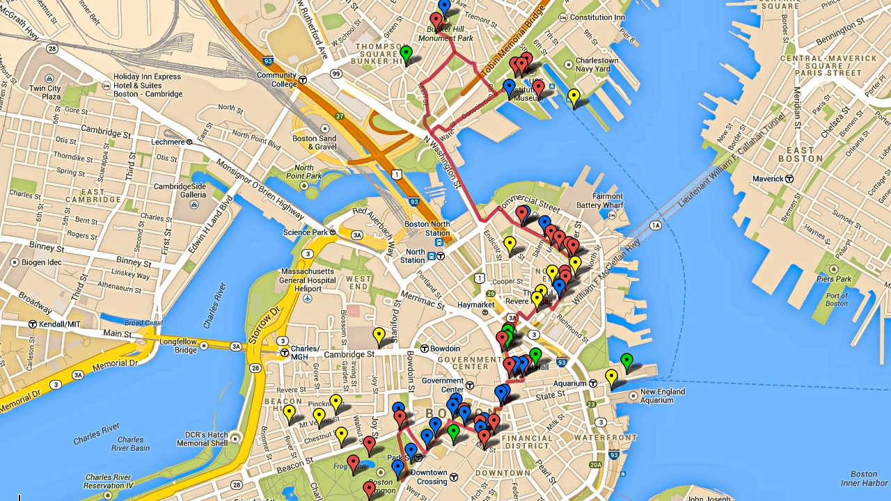
  1. Il n’ya aucune raison historique à faire les Stops du Freedom Trail dans l’ordre – organisez votre temps de manière à visiter ce qui vous passionne le plus. Parcourez les descriptions des Stops afin d’aider à évaluer votre intérêt.
  2. Veuillez vérifier afin de confirmer les modifications des heures d’exploitation – il peut y avoir des différences d’accès pendant les vacances, certains stops accueillent des événements spéciaux, ou peuvent être fermés pour rénovation. Voir le lien «Aujourd’hui, dans le parc” dans le Chapitre des Ressources.
  3. Bien que seulement 2,5 miles (4 km) de bout en bout, il est difficile de voir l’ensemble du Freedom Trail en une journée – surtout si vous voulez entrer et visiter l’un des Stops.
  4. Il ya d’excellents tours gratuits offerts par les rangers en uniforme du National Park Service (NPS). Les visites partent des Centres NPS à Faneuil Hall (Stop 11) ou depuis l’USS Constitution (Stop 15).
  5. Boston est une ville à pied, et le Freedom Trail ne fait pas exception. Apportez des chaussures confortables, de l’eau, de la crème solaire etc. Bien que les excellents transports publics de la ville de Boston peut vous emmener à la plupart des Stops du centre-ville (Stops 1-11), ceux de la North End et Charlestown ne sont pas bien déservis.
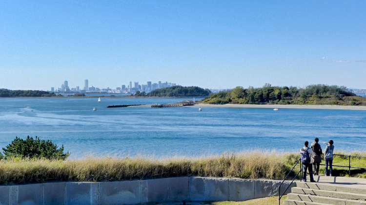
  6. Une façon amusante et peu coûteuse de se rendre ou de partir de Charlestown et du centre ville est la Navette Aquatique. Celle-ce traverse l’arrière-port entre Long Wharf (par l’Aquarium) et le Charlestown Navy Yard (près de l’USS Constitution).
  7. Les “Trolley Tours” du genre monte-et-descends sont de bons moyens de se déplacer, mais ils ne naviguent pas dans les rues du North End – vous aurez besoin de marcher vers / depuis la maison de Paul Revere, du Old North Church et Copp’s Hill.
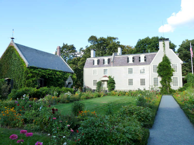
  8. Conseils les restaurants: les promos de homard sont souvent disponibles dans le bloc de Blackstone; une aire de restauration est dans le bâtiment principal de Quincy Market (par Faneuil Hall) avec des articles pour tous les goûts; Durgin Park, dans le bâtiment Quincy Market North Market est actif depuis 1827 et sert les mets favoris de la Nouvelle-Angleterre; l’Union Oyster House dans le bloc de Blackstone est le plus ancien restaurant en activité de l’Amérique, depuis 1826; le Chart House à Long Wharf est situé dans ce qui était la maison de comptage de John Hancock, datant de 1760; près de Bunker Hill, le Warren Tavern a été l’un des premiers bâtiments soulevés après que Charlestown ai été brûlée pendant la bataille de Bunker Hill, et a servi à acceuillir Paul Revere, George Washington et Benjamin Franklin; et il y a l’incomparable North End, où vous pouvez trouver n’importe quel type de festin à l’italienne imaginable.

波士顿自由之路介绍 – 怎样安排最佳游览路线!

Prescott SAdams & OldNorthChurch on Boston Freedom Trail

自由之路全长2.7英里

红砖标出的街道连接着

16处重要的历史古迹或“站点”。

Freedom Trail Google Map Enhanced

它的正式起点是在

波士顿公园,终点在查尔斯顿的

邦克山纪念碑。


在一天之内全部游览完比较困难特别是如果您想参观每个站点。


这里还有许多非正式的

站点 -当您漫步时

您所看到的和您想要了解的。


请记住,这些站点不是按历史顺序排列的,

尽管从地理位置上能看到有些站点很靠近。


大多数的站点是以革命时代主题,但其中一些最受欢宪法号战舰迎的站 还要古


根据您的兴趣和计划,请确定您有足够的时间去参观您想看的。


关于距离,直接从正式的

自由之路起点波士顿

公园到法纳尔大厅大约只有0.6英里(1公里),

不超过15分钟。


从法纳尔大厅步行到的保罗里维尔故居需要10到15分钟。到查尔斯顿站点还需步行15分钟从考普山墓地和旧北教堂。北边的最后的站点到宪法号战舰和邦克山纪念碑还需要和步行10分钟。


从查尔斯顿回到波士顿,最佳建议之一 – 因为

步行一天之后可能感到很乏味

可以坐水上巴士。它从查尔斯顿的宪法号博物馆后面的

海军船厂开始到水族馆和波士顿万豪酒店旁的

长码头为止。很有趣,价格也不贵(成人只需三美金12岁以下儿童免费),这是从港口体验波士顿风情的不错的。


方法 –怎么做的呢?


最推荐的是选择

免费的国家公园导游,从法纳尔大厅

开始,特别是参观北边时,

那是波士顿我最喜欢的地方。


我喜欢的站点宪法号战舰,小朋友们也都喜欢的;旧州府

大楼,有奇妙的博物馆,非常不错的解说。

有还优旧北教堂。


说实话,我并不想省略其它站点,但

如果时间非常有限,那些只能是候选。


祝您游览愉快!


请购买从亚马逊或在波士顿购买“波士顿自由之路 – 最终旅游和历史指南”。它包括自动翻译,交互式地图,智能手机应用程序,推荐路线,小提示,除了参观自由之路外,还有哈佛,列克星敦,以及更多!


从iTunes或Google Play下载免费的应用程序。https://www.stevestravelguide.com/?p=1122

Introduction to Lexington Battle Green

Virtually every visitor to historic Lexington will start at the Battle Green, the site of the first fight and the ‘Shot Heard ‘Round the World” on the British’ fateful march to capture Colonial military supplies stored in Concord. This short video provides useful context, military dispositions, and pictures of the attractions on and surrounding Lexington Battle Green. 
Enjoy.
[embedplusvideo height=”300″ width=”450″ editlink=”http://bit.ly/1eWpJmb” standard=”http://www.youtube.com/v/TMrDDcpeG_4?fs=1&hd=1″ vars=”ytid=TMrDDcpeG_4&width=450&height=300&start=&stop=&rs=w&hd=1&autoplay=0&react=1&chapters=&notes=” id=”ep7250″ /]
 

Divine Paradox at King’s Chapel: the Puritan – British Disputes & Role Reversals

King’s Chapel

Select your language to auto-translate:

EnglishEspañolFrançaisDeutschItalianoDansk中文(简体)中文(漢字)日本語한국어PortuguêsTürkçeالعربية

It is universally acknowledged that the Puritans who founded Boston in 1630 left England fleeing religious persecution from the Anglican Church majority (Anglican was England’s official state religion). But the religious freedom they sought was self-centered; they did not seek universal religious tolerance, but rather freedom to practice their own brand of Protestantism (which became Congregationalism), and to build a closed religious-political society around it. Nowhere was this more visibly noted than in US President William Howard Taft’s 1909 address, where he said “We speak with great satisfaction of the fact that our ancestors – and I claim New England ancestry – came to this country in order to establish freedom of religion,” declared Taft. “Well, if you are going to be exact, they came to this country to establish freedom of their religion, and not the freedom of anybody else’s religion.”

In Puritan New England, citizens had to conform to the Puritan religion and rules, or they were at best second class citizens. Those who did not accept the constraints were prosecuted, often ruthlessly. Roger Williams (in 1635) and Anne Hutchinson (in 1638) were both banished over what today would be considered trivial infractions, but at the time were considered heretical. Later, the Puritans tried to peaceably drive out the Quakers, but when peaceable means failed, whipping and execution followed. Catholics were treated little better and were universally hated and harangued. Only members of the Puritan church could hold office, vote, or even own property. And, the Puritans ability to operate in this manner – largely free from normal English oversight and freedoms – was guaranteed by a unique Royal Charter which gave them significantly more autonomy than was enjoyed by other English colonies.

But, the most intriguing conflict was between the Puritans and their Anglican fellow Englishmen. Even though they professed loyalty to the Crown, the Puritans despised the Anglicans, resisted their involvement in New England’s political affairs, and actively fought the establishment of Anglican houses of worship. One of the key issues was that the Anglican form of Protestantism was much closer to the hierarchical ornateness and ceremony of Catholicism than the ascetic, Calvinistic Congregationalism, the defining standard of Puritan society. Even though Puritan government was open only to Church members, it had a representative assembly and established the Town Meeting management process, with relative autonomy and decision authority given to the local church and town.  This is a sharp contrast to the hierarchical British Royal/Parliamentary system, where power was held centrally. The Puritan New Englanders did their best to avoid English meddling or oversight for as long as possible; and they managed to do this for almost fifty five years.

No place in historic Boston does the Puritan:Anglican struggle better play out than with King’s Chapel, the first official Anglican congregation in Boston (King’s Chapel is Stop 4 on Boston’s Freedom Trail and can be visited on the corner of Tremont and School Streets).  Anglicans were present in Boston from the beginning, but they were second class citizens without many rights. As early as 1646, Anglican Dr. Robert Child and several others sent a “Remonstrance and Petition” to the Massachusetts General Court, claiming among other things, that they were not free to pursue their religion. In response, the Court admonished and fined them – e.g., their request was summarily rejected. In 1662, a letter from King Charles II to the colony was direct in requiring that “the freedom and liberty should be duly and allowed to all such as desired to use the Book of Common Prayer, and perform the devotions in the manner established in England, and that they might not undergo any prejudice and disadvantage…” The King’s letter was ignored. In a 1664 follow-up, Royal commissioners were sent to Boston to see that the King’s instructions were followed. This delegation also was ignored and King Charles became too involved with issues in Europe to pursue it further.

Finally, in 1676, to follow-up on multiple complaints, King Charles sent Edward Randolph to Massachusetts to investigate. His reports to the King and key ministers clearly noted, along with many other issues, the religious persecution of Anglicans, and included a discussion of British subjects being put to death for religious reasons and the Puritan laws against the celebration of Christmas. Randolph’s campaign against New England ultimately led to the revocation of the Massachusetts Charter in 1684, and the installation of Sir Edmund Andros as Governor in 1686.

King’s Chapel was officially established by the authority of the Lord Bishop of London in mid-1686. The first public service was conducted at the Boston Town House (the precursor of the Old State House) in June, and the official “King’s Chapel” congregation was established soon thereafter. But, the congregation did not have a chapel, and use of the Town House was inappropriate. The same day as his arrival in Boston in December of 1686, Governor Andros started aggressive steps to find a suitable place for worship. Rebuffed by peaceable requests to share space in one of the Puritan meeting houses, in March Andros demanded the keys to Old South Meeting House and commandeered the building for Anglican services – from this point, the building would be shared by both congregations, with priority going to the Anglicans. His requests for land on which to build an Anglican Chapel rebuffed, Andros sized a portion of the town’s burying ground, had the bodies moved, and a Chapel started. The original wooden King’s Chapel was ready in 1689, and the Old South congregation returned to their normal service schedule.

The current granite chapel was started in 1749 when the original became too small. The new chapel was built around the old wooden one so as not to disturb the services. But more importantly, Puritan and Bostonian law also indicated that if the walls were knocked down, the land would revert back to Puritans control. When the new chapel was finished, the old one was dismantled and tossed out through the windows, boxed up and sent to Halifax, where it was reassembled. The new chapel opened for services in 1754.

King’s Chapel Interior

Far more opulent than austere Congregationalist meeting houses, King’s Chapel was the recipient of many lavish gifts from the British monarchy. King William III and Queen Mary II (1689 – 1702) sent money, communion silver, altar cloths, carpets and cushions. Queen Anne (1702 – 1714) gave vestments and red cushions. King George III (1760 – 1820) donated more silver communion pieces. The silver pieces vanished when over half of the parishioners fled (they were Royalists) when the British left after the Siege of Boston was lifted in 1776.

As the first Anglican foothold in Boston, King’s Chapel presents a number of fascinating and almost poetic paradoxes relating to the Puritan:Anglican conflict. George Washington attended two services at the Chapel: the first in 1753 when he was a British Colonel and guest of Royal Governor Shirley, and second when he was President of the United States in 1789 – he sat in the “Governor’s Pew”. As a replacement for some of the silver that vanished in 1776, Paul Revere crafted several new silver pieces for the congregation as thanks for King’s Chapel hosting the belated funeral for Doctor/General Joseph Warren in April of 1776; Warren died at the Battle of Bunker Hill in June of 1775. Finally, and to come full circle, King’s Chapel became the temporary home for the Old South Meeting House congregation, whose meeting house was undergoing repairs; Old South had been so emblematic of the Patriot cause that during the Siege of Boston, the British ripped out the pews and pulpit, used them for fuel and turned the vacant meeting house into a stable and riding school for British cavalry. The Old South Congregation held services at King’s Chapel for five years, much longer than the King’s Chapel parishioners had held the keys to Old South.

In 1782 the remaining Chapel’s parishioners (there were many Anglicans who were Patriots, not Loyalists) resumed regular services; and in 1787, the first Anglican church in Massachusetts became the first Unitarian church in America. Today, the Church is an independent congregation affiliated with the Unitarian Universalist Association (which in New England was largely an outgrowth of Congregationalism), but offers a unique liturgy that combines Unitarianism with Anglican traditions. Perhaps this now represents the fitting marriage of Puritan and Anglican traditions and cultures. Huzzah, or perhaps Hurray!


Long Wharf – the Heart of Colonial & Revolutionary Boston

Select your language to auto-translate:

EnglishEspañolFrançaisDeutschItalianoDansk中文(简体)中文(漢字)日本語한국어PortuguêsTürkçeالعربية

From the beginning, Boston was a town linked to the sea, with its success dependent on maritime trade and industry. And, its most important gateway to the sea in colonial times was Long Wharf. Originally called Boston Pier, Long Wharf construction began in 1711 (when Boston was the largest city in the Colonies), completed by 1715, and at its peak was almost 1,600 feet in length, 54 feet wide, and capable of docking up to 50 vessels. It was, by far, the largest and most significant wharf in Boston and was to play a major role in Boston’s economic and Revolutionary history.

Bonner’s 1722 Map illustrating Long Wharf & the Old State House

The heart of Colonial Boston was the Town House, Boston’s official town hall, which was at the base of King Street (King Street’s name was changed to State Street after the Revolution). The first Town House was built in 1657 and burned down during the Great Fire of 1711. It was replaced by the current “Old State House” in 1713, and was the location for the British Government until they evacuated Boston 1776. From the Town House, a viewer could look directly down King Street to the end of Long Wharf, see ships coming and going, and keep the pulse of the town.

Paul Revere’s 1768 Engraving of British Troops Landing on Long Wharf

As illustrated in the famous Paul Revere engraving above, British Troops landed on Long Wharf to help enforce the Townshend Acts in 1768. The oldest structure remaining on Long Wharf today, dating from around 1760 is a building that served as John Hancock’s “counting house” (primary place of business), who in, addition to being the famous signer of the Declaration of Independence, was one of the richest men and a leading merchant in Boston. Today John Hancock’s counting house is the Chart House restaurant.

British troops departed from Long Wharf when they left Boston in March of 1776. It was the landing place for the ship from Philadelphia bringing the Declaration of Independence (first read to the citizens from the balcony of the Old State House on July 18the 1776), privateers and blockade runners sailed from its docks, and its warehouses held military stores.

Water Shuttle Landing on Long Wharf

Today, Long Wharf is a great place to gather tourist information, take cruises of the harbor, and is the docking location for the water shuttles to the harbor islands and the Charlestown Navy Yard (USS Constitution). For an excellent posting on Long Wharf from a series by the National Park Service on maritime Boston, click here. The Aquarium is located at the end of Long Wharf.

Cambridge, Lexington & Concord: Freedom Trail Day Trips

Select your language to auto-translate:

EnglishEspañolFrançaisDeutschItalianoDansk中文(简体)中文(漢字)日本語한국어PortuguêsTürkçeالعربية


Cambridge

British Cannon on Cambridge Common

British Cannon on Cambridge Common

Cambridge, capitalized as “Newe Town” in 1632, is about five miles up the Charles River from Boston. It was established soon after Boston’s Puritan settlers arrived to provide a safe haven in event of an attack on the coastal Boston. The original village was located at the first convenient river crossing west of Boston, at what is now Harvard Square. Harvard College was founded here in 1636. The town served as the headquarters for the Patriot troops during the Siege of Boston.

Most tourists will want to visit Harvard University and take in the Revolutionary sites around Harvard Square. The best way to visit the area in a few hours is via a walking tour, which is offered by several companies.

I can recommend those from Cambridge Historical Tours, phone 617.520.4030, website here. The basic 90 minute walk covers the University and general Cambridge history; $12 for adults, $7 for children. For those interested in the Revolutionary-era, add the Tory Row option which extends the walk by ½ hour and costs an additional $3.

There are Free Student-Led & Self-Guided Walking Tours of Harvard Yard available directly from Harvard. For the self-guided tours, click here (includes a PDF map and audio files). For mobile phone versions of the self-guided tour, click here. For information about the free student-led tours, click here.

The Longfellow House, run by the National Park Service, is on Tory Row and is only a short walk from Harvard Square. In addition to being the home of poet Henry Wadsworth Longfellow, it was George Washington’s headquarters during the Siege of Boston. The NPS offers seasonal ranger-led tours, talks, and neighborhood walks. For hours and tour times, access the website here or call 617-876-4491. Admission is free.

Public transportation from Boston is easy and quick via the MBTA Red line to the Harvard Square station.

Lexington & Concord

Minuteman Statue on Lexiington Battle Green

Minuteman Statue on Lexington Battle Green

The nearby colonial towns of Lexington and Concord were the sites of the first significant battle of the American Revolution. A visit is highly worthwhile and an easy 1/2 to full day trip from Boston. Each year Massachusetts celebrates Patriots Day, around the April 19th anniversary of the battle, with reenactments and parades at many stops along the battle’s route. For more on the Battles of Lexington and Concord, click here. For a YouTube video intro to Lexington Battle Green, click here.

Most of the Lexington sites center on the Lexington Battle Green, at the site of the first skirmish. For maps and information, start at the Visitor Center, located next to the Battle Green. For Lexington information, click here or call 781-862-1450. There is a downloadable self-guided walking tour of the Battle Green area along with other information from the Lexington Historical Society, to download click here. Call 781-862-1703 to reach the Historical Society directly, website here. The Historical Society runs the Hancock-Clark House, Buckman Tavern, and Munroe Tavern. All offer tours by excellent docents and each offers a unique perspective. The Tourism Committee also runs free tours given by costumed guides, spring through fall . The narrated hop-on/off Liberty Ride, which runs to all the major sites from Lexington to Concord, is a fun way to travel and learn history at the same time.

Important visitor sites close to the Battle Green include the Minuteman Statue (paradoxically, Lexington never had minutemen, only militia), the Buckman Tavern (where the Minutemen gathered just prior to the battle), the Hancock-Clarke House (where Samuel Adams and John Hancock stayed the night before the battle), and the Old Belfry. The Historical Society runs the Hancock-Clark House, Buckman Tavern, and Munroe Tavern. All offer tours by excellent docents and each offers a unique perspective.

Just east of Lexington town center is the Munroe Tavern. The Munroe Tavern was the site of the British headquarters and field hospital during their retreat back to Boston. A packaged ticket for admission to the Munroe Tavern, the Hancock-Clarke House and the Buckman Tavern is available at any of the three houses: $12 for adults and $8 for children 6-16. Individual house admissions are $7 and $5 respectively. Contact the Lexington Historical Society to confirm the operating hours, which vary by season.

Concord was the site of the battle at North Bridge, but if you have time, it has a lot more to offer. For visitor information in the town center, go to the Concord Chamber of Commerce; open from the end of March until late October, and on the Thanksgiving weekend. Walking tours are available; admission is charged. The Chamber can be reached at 978-369-3120; to access their website, click here. To download a walking map of Concord, click here.

Important non-Revolutionary Concord sites include the Orchard House (home of Louisa May Alcott, where she wrote “Little Women;” admission charge), the Concord Museum (which has one of the two lanterns hung at Old North Church; admission charge), and The Wayside (home to the Alcotts, Nathaniel Hawthorne and Margaret Sidney; admission charge).

Most Revolutionary-centric visitors head directly to the Minuteman National Historical Park to visit the area around North Bridge. It is about 1/2 mile from the town center. For more on the Minuteman Park, see below.

For public transportation from Boston to Lexington, take the MBTA Red line to Alewife station and connect with either the #76 or #62 buses to Lexington. The ride from Alewife to Lexington is about 25 minutes. For the MBTA website, click here.

To Concord center, take the MBTA Commuter Rail from Boston’s North Station. The Fitchburg Line train stops at the Concord Depot on Thoreau Street. From the Depot, the North Bridge is a 1.5-mile walk.

For visitors to both Lexington and Concord traveling without cars, the best option is to travel to Lexington and take the Liberty Ride trolley mentioned above. The trolley stops near all major sites in both towns and provides hop-on and off service, giving the opportunity to hike portions of the Battle Road. It runs on weekends in April and May, then daily until October 28. Adult tickets are $25, children 5-17 are $10. It also includes admission to the Lexington houses mentioned above. For Liberty Ride information, call 781 781-862-0500, website here.

Minuteman National Historical Park

North Bridge from  NPS Visitor Center

North Bridge from NPS Visitor Center

North Bridge seen from the NPS Visitor Center

The Minuteman National Historical Park, run by the National Park Service, has two sections. The eastern section follows the Battle Road from just outside Lexington into Concord. The western section covers the area around North Bridge, just beyond Concord center. Both have visitor centers and ranger-guided tours and talks. All programs are free, with the exception of an admission charge to the Wayside; $5 for adults, free for children 16 and under. For full park information visit the NPS website here or call 978-369-6993. For an interesting website on the Battle Road, click here.

The visitor center at the eastern end of the park (nearest Lexington) features a very good multi-media show, “The Road to Revolution,” especially entertaining for children. The center also has exhibits, dioramas, and other battle-related information. Rangers are on duty to answer questions and there is a small gift shop.

The five mile Battle Road makes for a great hike and much of it has been restored to a state similar to Revolutionary times. Be sure to visit the Hartwell Tavern, which is representative of an authentic period home-tavern and has ranger-programs from May through October. The Paul Revere Capture Site, just off Route 2A, is a frequent visitor stop.

West of Battle Road, and the closest stop to Concord center, is The Wayside. In Revolutionary times, The Wayside was home to the muster master of the Concord Minute Men. Later, it became the “Home of Authors,” with its residents including Louisa May Alcott, Nathaniel Hawthorne, and Harriett Lothrop (Margaret Sidney). As of this update, the Wayside has been closed for renovations. The Wayside is next door to Orchard House, which charges a separate admission fee and is not associated with the Park.

The western section around North Bridge has a small visitor center set spectacularly on the hill overlooking the bridge. It features a few small exhibits and a very good three dimensional map that illustrates the topography of the important battle sites. It is located in a mansion that once belonged to the Buttrick family. Major John Buttrick was the Patriot who ordered the colonials to fire on the British at North Bridge.

For public transportation to the eastern visitor center from Boston, take the MBTA Red line to Alewife station and connect with the #76 bus to the Old Mass Ave & Marrett Road stop in Lexington. Ask the driver to point out the stop. There is no service on Sunday. To the western section, follow the directions to Concord center, above. The Liberty Ride stops at both sections as well as at Hartwell Tavern, Meriam’s Corner, North Bridge and other park sites.

Adams National Historical Park

Birthplace of John Adams

Birthplace of John Adams

Birthplace of John Adams

An easy, rewarding, and often-overlooked Freedom Trail side-trip is to the Adams National Historical Park in Quincy. The park includes the homes of American presidents John Adams (the famous Patriot and 2nd US President), his son, John Quincy Adams (the 6th president), and their descendants from 1720 to 1927. The park is right off of the MBTA Red line and is a simple, quick, and inexpensive trip from Boston. The park is open from mid-April until mid-November. Check their website here or call 617-770-1175. For a web-translation of this section, click here.

A visit starts at the NPS visitor center – access to the homes is only permitted via ranger-led tours. Tours run two hours and cost $5 for adults; children under 16 and holders of a National Park America the Beautiful Passes are free. Before leaving the visitor center, view the excellent short film, “Enduring Legacy,” that overviews the Adams’ lives and accomplishments – it is excellent.

The first stop is at the presidents’ birthplaces. To start, you will visit the wonderful, sparse, “saltbox” house (c. 1681) where John was born in 1735. Only 75 feet away is the house where John and Abigail gave birth to John Quincy in 1767. That house also holds the law office where John drafted the Massachusetts Constitution, which later served as the model for the US Constitution.

The next stop is at the “Old House.” Built in 1731, it was purchased by John and Abigail as a more suitable residence after their return from John’s diplomatic posting to London in 1788. The Adams family expanded the home from its original seven rooms to what you visit today. It was also home to John Quincy, his son Charles Francis (ambassador to Great Britain during the Civil War) and their descendants. It served as a summer White House and is full of original family artifacts and art that helps tell the Adams’ story – a real treasure to visit.

Adams Old House  with Stone Library & Garden

Adams Old House with Stone Library & Garden

Next door to the Old House, set in a beautiful garden, is the Stone Library, built in 1873. This serves as the John Quincy Adams presidential library and holds over 14,000 books, artifacts and family paintings.

Across the street from the visitor center, but not part of the National Park, is the United First Parish Church. The Church contains the tombs of John, Abigail, John Quincy and Louisa Catherine Adams, website here. Founded in 1636 as a branch of the Puritan church in Boston, this is the fourth Church building erected on this site. Designed by Alexander Paris (also designer of Quincy Market), it was completed in 1828, with granite and funding from John Adams. If you have time, take the brief tour of the church and the crypt; a small donation is requested. Tours are available on the same schedule as the National Historical Park, from mid-April through mid-November.

Boston Harbor Islands

View from Georges Island Artillery Observation Tower

Boston from Georges Island Artillery Observation Tower

A fantastic trip and relaxing change from Revolutionary Boston is a visit to the Harbor Islands National Recreation Area. At the Islands you can visit a Civil War era fort, swim, picnic, hike, bird watch, camp, enjoy a concert, or just delight on the wonderful, narrated cruise through the Harbor. For the younger visitors there is even a playground with an amazing view of the Boston skyline. The Islands are a cooperative effort between the National Park Service and various Commonwealth, City and private groups.

The park itself features 12 islands and peninsulas, and even the oldest active lighthouse station in the United States (used since 1716, only accessible via a special “Lighthouse Tour”); practically, you can visit a maximum of two Islands per day – visiting a single Island requires at least ½ day, but don’t rush. There is a snack shack with a seafood menu on Georges Island, but the food quality can be variable – so you may want to pack a lunch. There is an expertly-staffed pavilion on the Rose Kennedy Greenway between Quincy Market and Long Wharf to help plan your visit, purchase ferry tickets, etc.

Although ferries run from several suburban locations, most visitors will take the ferry the north side of Long Wharf (by Christopher Columbus Park); the ferries take you to either George’s or Spectacle Island. From George’s Island, during the summer, there are connections to other islands. Fares are: Adults, $15; children 4-11, $9; over 65, $11, inter-island, $3. Regular service runs May through Columbus Day in the fall, but there are various winter visit opportunities. Definitely visit the website for current and detailed visiting and transportation information.

There is a very well done Visitor Center on Georges Island with interpretive exhibits highlighting the Islands’ history, their role in the defense of Boston, the impacts of changing military technology, even the respective diets of enlisted men and officers – fascinating even for the non-military-oriented visitor. Unless you know you want your stop to be Spectacle Island, stop here first, watch the eight minute video and plan the rest of your visit. Rangers are there to help.

There are excellent Ranger-led tours of the Civil War era Fort Warren, which was built between 1833 and 1861 (self-guided tours are also available). During the Civil War, the fort served as a prison for over 1,000 Confederate personnel, the most famous the Confederate Vice President Alexander Stephens. Fort Warren remained active through the Spanish-American War and World War I. During World War II, it was part of the harbor’s defense from German U-boats. Over the years it was modified to accommodate changing cannon technology. It was permanently decommissioned in the 1950’s when guided missiles obsoleted cannon for coastal defense.

A visit is highly recommended and suitable for all ages. Handicap access, however, is limited; please check the website for detailed information.

Useful links for a Boston Harbor Islands visit:

  • The official Boston Harbor Islands website.

  • National Park Service website.

  • National Park Service map of the Islands, download here.

  • Boston Harbor Islands YouTube channel, here.

  • Ferry website.

  • The Boston Harbor Island Alliance website.

Georges Island Visitor Center


Freedom Trail Tour Guide – Maps, Sites, Tips & Secrets

Select your language to auto-translate:

EnglishEspañolFrançaisDeutschItalianoDansk中文(简体)中文(漢字)日本語한국어PortuguêsTürkçeالعربية

“… just the right mix of content to make for a terrific tour…” David J. Asher  “Saved me with visitors from the West Coast…”  Steve S.

Download the free companion Apps – use with the Guide or when visiting the Freedom Trail!

For the iPhone                 For Android 

The Freedom Trail Boston – Ultimate Tour & History Guide provides everything you need to bring your visit to The Freedom Trail to life. Use it to plan your visit, as a interactive tour guide, or even as a souvenir! Includes FREE STREAMING AUDIO NARRATION – a personal tour guide in your pocket (requires web access)!

The most comprehensive guide available, by far!

  • Overview and detailed background information for all 16 Official and >50 Unofficial Freedom Trail Stops
  • Side trips to Harvard Square/Cambridge, Lexington, Concord, Adams NHP, & Boston Harbor Islands
  • Available in print or ebook formats.
  • Print version retains ebook features with QR Code access to auto-translate and web materials
  • > 70 photographs, maps and illustrations
  • Auto-translate all major book chapters (with web-access) into Spanish, French, German, Italian, Japanese, Chinese, Korean and more
  • Access to additional free information including an interactive Google Map Tour, an Android app and iPhone/Pad app
  • Budget tips including the best free guided-tours, where to find a bargain lobster, historic restaurants, and even a harbor cruise for $3 (children are free)
  • Detailed itineraries for an hour, 1/2, full and two day visits. Learn exactly what to visit with your limited time
  • Child-friendly and family-oriented tips
  • Descriptions of all the events that bring the Freedom Trail to life including the Boston Massacre, the Boston Tea Party, Paul Revere’s Ride, the Battles of Lexington and Concord, and the Battle of Bunker Hill – more than is provided by any other tour guide


What is The Freedom Trail?

Freedom Trail Logo Boston

Welcome to The Freedom Trail

The Freedom Trail is the largest attraction in New England, with over three million visitors a year. It is fun, walkable, accessible, family-friendly, engaging, and a bargain. You can see it in 1/2 a day, or spend several days and still want more.

Select your language to auto-translate:

EnglishEspañolFrançaisDeutschItalianoDansk中文(简体)中文(漢字)日本語한국어PortuguêsTürkçeالعربية

And, Boston has everything you might want in a destination – world class museums, fantastic restaurants, shopping, sports, music, theater and history. It’s a unique and charming place that can feed almost any passion. There are great options for almost any budget, even a bargain lobster lunch.

So, what is it? The Freedom Trail is a 2.5 mile red brick path  (mostly brick – some lines are painted) that connects 16 significant historic sites, referred to as “Stops” throughout this blog.  The Trail starts at Boston Common and officially ends at the Bunker Hill Monument in Charlestown.

Most of the Stops are free and many are handicapped accessible, but some may be difficult to navigate for non-walkers. For the few that charge admission, there are discounted tickets available.

The original idea for The Freedom Trail was conceived by William Schofield, a long-time journalist for the now defunct Boston newspaper, the Herald Traveler. In 1951, Schofield had the idea for a walking path that connected Boston’s great collection of local landmarks. With the support of local historians, politicians and businessmen, the Freedom Trail was born.

In addition to the official Stops, there are many “unofficial Stops” you pass as you traverse the Trail, or are very near by. Most unofficial Stops are directly associated with Revolutionary Boston and The Freedom Trail, but some are simply interesting places.  Many folks include them in their Freedom Trail visit.

So, how should you plan for your visit, and for how long? The posts on Planning to Tour, Part 1 and Part 2, will give you an overview of all the official Stops, a sense of how long it takes to visit each, and alternative itineraries for 1/2, full and two day tours. Use this free custom Google Map to help visualize your visit – it is practically a full blown self-touring guide in itself. For a complete view of The Freedom Trail, get a copy of the “Freedom Trail Boston – Ultimate Tour & History Guide – Tips, Secrets & Tricks“.

The influence Boston had on the thinking and actions that led to the American Revolution was extraordinary. Without Boston and its unique history, the American colonies break with Great Britain may have still happened, but not when and how it did. The Freedom Trail presents the essence of Revolutionary Boston and brings its amazing impact to life.

Enjoy, Boston is a unique city and The Freedom Trail is a national treasure.

Freedom Trail Boston Video Virtual Tour in 5 Minutes

A 5 minute comprehensive video walk through of The Freedom Trail, it features all the 16 official Freedom Trail Stops, more than 50 unofficial Stops, historic restaurants, and other interesting places in and around The Freedom Trail – all included in theFreedom Trail Boston – Ultimate Tour Guide – Tips, Secrets & Tricks eBook. It moves fast as it contains almost 150 photos and video segments, so keep your pause key handy if you want to view anything in detail. A must see for anyone visiting The Freedom Trail and Colonial Boston.

The video was created as a companion to the  eBook “Freedom Trail Boston – Ultimate Tour and History Guide,” now available on Amazon.com. The Guide covers all of the sites in the video and more. In addition to any touring information the reader might need, the Guide provides detailed historical context from the time of Boston’s founding through events like the Boston Massacre, the Boston Tea Party, Paul Revere’s Ride, the Battles of Lexington and Concord, and the Charles Bulfinch era. In short, it contains everything someone might want to know to visit and enjoy The Freedom Trail and Revolutionary Boston.

For a companion map to the video, see my custom Google Map posting. The map includes everything in the video.

Enjoy the video!

Boston’s North End – More Than “Little Italy,” A Brief History

Select your language to auto-translate:

EnglishEspañolFrançaisDeutschItalianoDansk中文(简体)中文(漢字)日本語한국어PortuguêsTürkçeالعربية

Most people know the North End as Boston’s Little Italy. But, Italians did not start moving into the North End in any significant number until the 1880’s – some 260 years after the North End’s earliest residents. The Italians were only the last of a series of ethnic groups to inhabit this area of Boston.

Boston's North End

Entering Boston’s Historic North End

Originally, the North End was a suburb for the Puritan families who migrated to Boston during the 1630’s. At that time, the North End was isolated, virtually an island surrounded by water on three sides, connected to the rest of Boston by a small neck of land.

Over time, was the land connecting the North End to Boston was filled-in, but the North End remained geographically isolated until the completion of the Big Dig in 2007. In recent history, and prior to the Big Dig’s completion, easy entry to the North End was blocked by the elevated Central Artery (Route 93).

By the mid 1640’s the North End had evolved into its own distinct community. By 1649, it was large enough to have its own church, the North Meeting House (later called Boston’s Second Church).

In 1659, the North End established its own Burying Ground, Copp’s Hill. Copp’s Hill took its name from William Copp, a shoemaker who had owned once owned the land. Copp’s Hill was also home to a free black population, many of whom are interred in the Burying Ground.

North Square boston

North Square – Looking at Site of Second Meeting House

The area around the North Meeting House developed into North Square, which quickly became the center of North End life. At that time, North Square was only one block from the harbor.

Increase Mather, the minister of the North Meeting House, had his home in North Square. It, along with the Meeting House and a number of surrounding buildings, was destroyed in the fire of 1673. The Meeting House was rebuilt and subsequently torn down by the British and used for firewood during the Siege of Boston between 1775 and 1776.

Paul Revere House in North Square

Paul Revere House in North Square

The Paul Revere house was constructed in 1680 where Mather’s home had once stood. Revere purchased it in 1770 and lived here until the 1780’s, when he moved a few blocks away to a house with a harbor view. The Pierce / Hitchborn house, next door to the Revere House, was built around 1711. These houses, along with the Old Corner Book Store and Old State House are the oldest remaining structures in Boston.

The opulent Clark-Frankland and Hutchinson mansions were build just off of North Square after 1710. Hutchinson’s mansion was gutted in 1765 in protest over the Stamp Act. Both the Clark-Frankland and Hutchinson mansions were torn down in 1834 to allow for street widening.

In 1890, Rose Fitzgerald (Kennedy) was born at 4 Garden Court Street, just across the street from where the Hutchinson mansion had stood. Rose later married Joseph P. Kennedy and was the mother of President John F. Kennedy, and Senators Robert and Edward Kennedy. There is a plaque marking the site of her birth on Garden Street just off of North Square. In the mid 1800s, North Square was also home to two Bethels – churches specifically built to minister to the needs of sailors.

Paul Revere & Old North Church

Paul Revere Statue w/View of Old North Church

In 1721, the construction of the Anglican Christ Church (Old North) began and was completed in 1723. In 1775, the Christ Church belfry was used to hang the “two if by sea” lanterns that warned Patriots of the British march on Lexington and Concord and was the start of Paul Revere’s Ride.

The Charles Bulfinch designed New North Congregational Church on Hanover Street was built between 1802 and 1804.  The Church was originally Congregationalist, but it switched to Unitarian in 1813.  It was sold to the Roman Catholic Diocese of Boston in 1862. It is the last Bulfinch designed church standing in Boston.

After the American Revolution, the North End began transitioning to a largely working class neighborhood with the influx of labor associated with the shipping industry. Wharfs and warehouses were built to support maritime trade and shipbuilding. And, along with the often drunken and violent sailors, came the requisite gamblers, whores and criminals. To proper Bostonians, it became a dangerous slum, a place to be avoided.

From early on there was an Irish population in Boston. Their numbers were small, but grew to about 7,000 by 1830. The Irish population really swelled during the Great Potato Famine when a reported 13,000+ Irish moved to Boston during 1847 alone. The North End was their primary destination.

By 1850, over half the North End’s population of 23,000 was Irish. This peaked at about 15,000 in 1880. With the influx of new ethnic groups, many of the Irish moved to the South End. By 1890, North End’s Irish population had dropped to 5,000 and by the turn of the century it was down to 3,000.

In the 1870’s, the North End became home to an Eastern European Jewish population. In the early 1900s, Jews made up almost one third of the North End’s population, many settling along Salem Street. By the 1920’s, most had moved to Boston’s West and South End, then on to Dorchester, Brookline, Newton, Chelsea and Revere.

The last ethnic group to settle in the North End was the Italians. Immigration started in the 1860s with a small group from Genoa. This was followed by and influx from other Italian regions including Sicily, Milan, and Naples. Each regional group settled in its own distinct North End enclave.

By 1900, the North End Italian population had reached 14,000. By 1920, this number grew to 37,000, with its peak of more than 44,000 in 1930. The North End was now almost completely Italian – and very crowded.

The census puts today’s North End population at about 10,000, of which only 40% are of Italian descent. The remaining residents are a mix of young professionals, college students and others. North End politics are still dominated by Italian Americans.

The North End remains Boston’s Little Italy. It retains a wonderful and distinct “Old Word” feeling and boasts fantastic collection of new and old Italian restaurants, cafes, bakeries and markets.  It is one of the most European-feeling neighborhoods in America.

It is the oldest neighborhood in Boston.  Having existed for over 375 years, is home to some of the most important and historic venues in America as well as some of the most significant Freedom Trail sites.

For more historical information, visit this wonderful five part series by Guild Nichols.

Freedom Trail Maps with Google Map Tour

Any visitor to the Freedom Trail and Colonial Boston will need good maps.  Here are several – all free.

The Google map below was created for the eBook Freedom Trail Boston – Ultimate Tour and History Guide. In itself, the map is almost a full tour guide and includes the essentials for all the official, as well as many interesting unofficial Freedom Trail sites. All of the Official Stops come with web-based auto-translate links that allow the user to specify the language for the post. A great feature for non-English comfortable users.

The map also provides information such as operating hours, websites, phone numbers, admission costs and handicap access notes.  There are even listings for the best historic restaurants. Here is a video post that includes all the sites listed in the map.

The map is also available as a FREE full-blown Android app, downloadable from Google Play as well as from the Amazon App Store. The app exposes all the best features of Google Maps and is, by far, the most usable way to use the map. It  performs better than using a browser, is much less awkward, and lets you keep the map easily identifiable and ready to launch.

Use it (at your own risk as travel information is subject to change), enjoy it, and please comment.  Pass the link on to your friends.

View Freedom Trail Map & Historic Boston Guide in a larger map


Next is a series of official Freedom Trail maps from the US National Park Service (NPS).  These are savable, printable,  well done and all paid for by US tax dollars.

The main Freedom Trail Map, which is the same that you will see on the NPS Freedom Trail Guide paper guide, is available here.  It is also available from The Freedom Trail Foundation here.  Additionally, there are other relevant visitor maps available from the National Park Service – for the whole series click here.  In addition to the official Freedom Trail map mentioned above, there is a less detailed Freedom Trail map with an outline of Boston’s harbor line at 1775 – fascinating for historical context.  Click here for the 1775 overlay map.  The series also includes maps for the Charlestown Navy Yard,  Boston Harbor in WW II, a map that shows walking distances between Boston sites (Boston is a very walkable city), and a guide for tour bus parking.


Isles of Shoals


View Larger Map
Visiting the Isles of Shoals makes a wonderful day trip out of Portsmouth harbor. Catch a ferry with the Isles of Shoals Steamship Company at 315 Market Street in downtown Portsmouth for the 9 mile ride out the Islands. The Steamship Company offers various excursions that include guided Portsmouth Harbor tours or stops for exploring the islands.

View Larger Map
The cruise out to the islands is a wonderful way to spend a few hours. The narrated ride passes through Portsmouth Harbor, which is beautiful and features history and sites galore. To port (on the Maine side of the Harbor – left on the way out to the islands), you will pass the Portsmouth Naval Shipyard and the abandoned Naval prison. Watch for submarine conning towers that may be visible as you pass by.

To starboard you will pass Fort Constitution at the mouth of the harbor. Fort Constitution is built on the site of Fort William and Mary, which was the site of the true first organized action by the Colonials against the British in 1774 – before Lexington and Concord! On December 13, 1774, Paul Revere (remember him from the Midnight Ride) rode 60 miles from Boston to Portsmouth and informed the The Portsmouth Committees of Safety and Correspondence that a British expedition that was in transit by sea to seize control of the powder and armaments stored at the fort. On the following day, a band of 400 New Hampshire militiamen assaulted the fort, which was manned by just 6 British soldiers. The British managed to fire three cannons at the Colonials, but were quickly overwhelmed. A large amount of gunpowder was captured along with some muskets and cannon. There were no serious injuries, but this was truly the first battle of the American Revolutionary War, a full four months before Concord and Lexington.

Site of Fort William and Mary - First Colonial Action Against British


The ferry will stop at Star IslandStar Island to drop off and pick up passengers. At the island, there is a retreat hotel run by the Unitarian Church. They offer day services including meals and it is possible to spend the night between mid-June and mid-September. The organization runs various retreats, workshops and conferences that run from photography to international affairs to family conferences. The facility is beautiful and a real throwback to the 19th century – Nathanial Hawthorne stayed here. Accommodations are pretty basic, but the location is fantastic. A beautiful and quite place to spend a day or a few nights.