Ultimate Freedom Trail Tour Guide & Apps – Tips, Secrets & More

Select your language to auto-translate:

EnglishEspañolFrançaisDeutschItalianoDansk中文(简体)中文(漢字)日本語한국어PortuguêsTürkçeالعربية

“… just the right mix of content to make for a terrific tour…” David J. Asher  “Saved me with visitors from the West Coast…”  Steve S.

Download the free Apps – use with the Guide or by themselves when visiting the Freedom Trail!

For the iPhone                 For Android 

The Freedom Trail Boston – Ultimate Tour & History Guide provides everything you need to bring your visit to The Freedom Trail to life. Use it to plan your visit, as a interactive tour guide, or even as a souvenir! Includes FREE STREAMING AUDIO NARRATION – a personal tour guide in your pocket (requires web access)!

The most comprehensive guide available, by far!

  • Overview and detailed background information for all 16 Official and >50 Unofficial Freedom Trail Stops
  • Side trips to Harvard Square/Cambridge, Lexington, Concord, Adams NHP, & Boston Harbor Islands
  • Available in print or ebook formats.
  • Print version retains ebook features with QR Code access to auto-translate and web materials
  • > 70 photographs, maps and illustrations
  • Auto-translate all major book chapters (with web-access) into Spanish, French, German, Italian, Japanese, Chinese, Korean and more
  • Access to additional free information including an interactive Google Map Tour, an Android app and iPhone/Pad app
  • Budget tips including the best free guided-tours, where to find a bargain lobster, historic restaurants, and even a harbor cruise for $3 (children are free)
  • Detailed itineraries for an hour, 1/2, full and two day visits. Learn exactly what to visit with your limited time
  • Child-friendly and family-oriented tips
  • Descriptions of all the events that bring the Freedom Trail to life including the Boston Massacre, the Boston Tea Party, Paul Revere’s Ride, the Battles of Lexington and Concord, and the Battle of Bunker Hill – more than is provided by any other tour guide


波士顿自由之路介绍 – 怎样安排最佳游览路线!

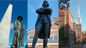
Prescott SAdams & OldNorthChurch on Boston Freedom Trail

自由之路全长2.7英里

红砖标出的街道连接着

16处重要的历史古迹或“站点”。

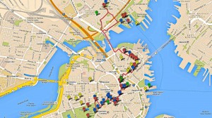
Freedom Trail Google Map Enhanced

它的正式起点是在

波士顿公园,终点在查尔斯顿的

邦克山纪念碑。


在一天之内全部游览完比较困难特别是如果您想参观每个站点。


这里还有许多非正式的

站点 -当您漫步时

您所看到的和您想要了解的。


请记住,这些站点不是按历史顺序排列的,

尽管从地理位置上能看到有些站点很靠近。


大多数的站点是以革命时代主题,但其中一些最受欢宪法号战舰迎的站 还要古


根据您的兴趣和计划,请确定您有足够的时间去参观您想看的。


关于距离,直接从正式的

自由之路起点波士顿

公园到法纳尔大厅大约只有0.6英里(1公里),

不超过15分钟。


从法纳尔大厅步行到的保罗里维尔故居需要10到15分钟。到查尔斯顿站点还需步行15分钟从考普山墓地和旧北教堂。北边的最后的站点到宪法号战舰和邦克山纪念碑还需要和步行10分钟。


从查尔斯顿回到波士顿,最佳建议之一 – 因为

步行一天之后可能感到很乏味

可以坐水上巴士。它从查尔斯顿的宪法号博物馆后面的

海军船厂开始到水族馆和波士顿万豪酒店旁的

长码头为止。很有趣,价格也不贵(成人只需三美金12岁以下儿童免费),这是从港口体验波士顿风情的不错的。


方法 –怎么做的呢?


最推荐的是选择

免费的国家公园导游,从法纳尔大厅

开始,特别是参观北边时,

那是波士顿我最喜欢的地方。


我喜欢的站点宪法号战舰,小朋友们也都喜欢的;旧州府

大楼,有奇妙的博物馆,非常不错的解说。

有还优旧北教堂。


说实话,我并不想省略其它站点,但

如果时间非常有限,那些只能是候选。


祝您游览愉快!


请购买从亚马逊或在波士顿购买“波士顿自由之路 – 最终旅游和历史指南”。它包括自动翻译,交互式地图,智能手机应用程序,推荐路线,小提示,除了参观自由之路外,还有哈佛,列克星敦,以及更多!


从iTunes或Google Play下载免费的应用程序。https://www.stevestravelguide.com/?p=1122

Freedom Trail Boston Visit Planning Video

Posted this as an intro for folks planning to visit the Freedom Trail.  Hope that it is helpful to visualize the trail length and breadth as well as some of the Stops.

Enjoy and have a great visit.


Musket Firing Demo at Minuteman National Historical Park

Attended a wonderful 3.5 hour walk, led by Ranger David Hannigan, of the Battle Road between Concord and Lexington.  When passing by the Hartwell Tavern, we had the opportunity to view this Musket Firing Demo by Ranger Charlie Webster. It was done according to the standard British 1764 Manual of Arms, which was used by both British and Colonial forces.
[embedplusvideo height=”281″ width=”450″ editlink=”http://bit.ly/16CebLT” standard=”http://www.youtube.com/v/1ZzBaBad75Q?fs=1&hd=1″ vars=”ytid=1ZzBaBad75Q&width=450&height=281&start=&stop=&rs=w&hd=1&autoplay=0&react=1&chapters=&notes=” id=”ep8490″ /]

Click for the Minuteman National Historical Park schedule of events. The 3.5 hour Battle Road Walk, wonderful for those interested in detailed Battle information, is given monthly, June through October.

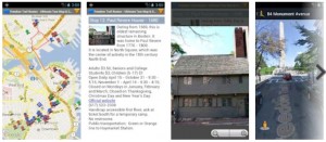
Freedom Trail Map & Tour App w/Auto Translate – Free!

Freedom Trail Boston Map & Tour App


The Freedom Trail Map & Touring App is now available on Google Play as well as Amazon  It is based on the interactive Google Map created for the Freedom Trail Boston – Ultimate Tour Guide – Tips, Secrets & Tricks eBook.

Select your language to auto-translate:

EnglishEspañolFrançaisDeutschItalianoDansk中文(简体)中文(漢字)日本語한국어PortuguêsTürkçeالعربية

The app is much faster and easier to use than the browser version and it exposes all the most powerful features of Google Maps including street mode, local search, directions, and local transportation information. The map itself contains all 16 official Freedom Trail Stops and over 50 additional interesting sites on or close to The Freedom Trail.

An innovative ability for international travelers is the web-based auto-translate feature.  By selecting auto-translate on selected map entries, users with internet-access will access a web site where they can elect to read the entry in Spanish, French, German, Japanese, Mandarin, Korean and other languages.

The app is the perfect companion for planning or when walking The Freedom Trail.

High-Resolution Photos from Freedom Trail Boston – Ultimate Tour & History Guide

Select your language to auto-translate:

EnglishEspañolFrançaisDeutschItalianoDansk中文(简体)中文(漢字)日本語한국어PortuguêsTürkçeالعربية

One of the great frustrations in publishing an eBook is that the publisher is megabyte constrained – e.g., there is an incentive to keep eBooks small.

High resolution photos use up a lot of megs.  So, to keep things small, the photos in the eBook are either 800 x 600 or 640 x 480 and have been compressed. They are illustrative and fine for an eReader, tablet or phone, but this resolution does not do them justice as photographs.

The gallery below contains the photos used in the “Freedom Trail Boston – Ultimate Tour & History Guide – Tips, Secrets & Tricks” eBook in 2048 x 1536 format compressed to +/- .5 meg each.  I’ve also include a few pictures that simply did not fit or that are representative of what you will see on and around the Freedom Trail. If anyone is interested in one in native format, 4000 x 3000 +/- 5 meg each, email me and we’ll figure something out.

Warmest regards,

Steve

Bunker Hill Monument – Freedom Trail Stop 16 Overview

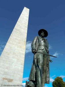
Prescott at the Bunker Hill Monument - Freedom Trail Stop 16

Prescott at the Bunker Hill Monument – Freedom Trail Stop 16

Select your language to auto-translate:

EnglishEspañolFrançaisDeutschItalianoDansk中文(简体)中文(漢字)日本語한국어PortuguêsTürkçeالعربية

“The Whites of Their Eyes”

The monument is located on Breed’s Hill at the site of the Patriot redoubt during the Battle of Bunker Hill, which was fought on June 17, 1775.

Free

Daily 9 – 5; last climb at 4:30. July and August 9 – 6; last climb at 5:30

Official website:

http://www.nps.gov/bost/historyculture/bhm.htm

617-242-5601

Handicap access to the lodge next to monument is via a ramp. The monument has 294 steps to the top.

Restrooms are in Bunker Hill Museum basement, across the street.

The Bunker Hill Museum (recommended – across the street), is fully accessible with elevators and restrooms.

Museum website:

http://www.nps.gov/bost/historyculture/bhmuseum.htm

Background information

Most visitors to the Bunker Hill Monument will stop at the Bunker Hill Museum, and we highly recommend visiting. Run by the National Park Service, the museum is just across the street from the steps to the base of the monument. It is excellent, featuring very well done interpretive displays and dioramas and ranger-led programs, which are often oriented to children. There are full bathroom facilities and it is handicap accessible. Everything is free.

Proceeding across the street from the museum and up the steps to the monument, you will pass the statue of Colonel William Prescott (pictured above), Patriot commander during the battle. Some legends identify Prescott as the man who uttered “don’t fire until you see the whites of their eyes.” Two superior officers were present at the battle, Major Generals Israel Putnam and Joseph Warren, but both declined to take command from Prescott.

The current obelisk is the second monument erected to commemorate the battle. The first was an 18-foot wooden pillar with a gilt urn that was erected in 1794. In 1823, the Bunker Hill Monument Association was formed by a group of prominent citizens who desired a more fitting memorial.

The 221-foot high monument is located on Breed’s Hill, at the site of the Patriot redoubt during the battle. The monument is constructed of granite from Quincy, Massachusetts – the same site that provided the granite for Dry Dock 1 in the Charlestown Navy Yard. A special railroad, the first common carrier in the United States, was built to haul the granite from Quincy to Boston. The final leg of the granite’s journey across the harbor was by barge.

Construction started in 1827 but was not completed until 1843 as there were many funding-related delays. To finish the project, the Monument Association actually had to sell off part of their original land, leaving only the summit of Breed’s Hill that you see today.

The small exhibit lodge adjacent to the monument was constructed in the late 1800s and houses a few statues and paintings, including a particularly good one of Doctor/General Joseph Warren. The Bunker Hill Monument Association maintained the monument and grounds until 1919 when it was turned over to the Commonwealth of Massachusetts. In 1976 the monument was transferred to the National Park Service.

To ascend the 294 steps to the top of the monument, pass through the lodge and head up. It is recommended that you be confident in your ability to complete the round trip as there is no elevator and no place to sit down, except on the staircase. Climbers to the top will enjoy a great view of Boston and the surrounding areas.

Charlestown Navy Yard – Freedom Trail Stop with Old Ironsides

Charlestown Navy Yard

Charlestown Navy Yard – On The Freedom Trail

Select your language to auto-translate:

EnglishEspañolFrançaisDeutschItalianoDansk中文(简体)中文(漢字)日本語한국어PortuguêsTürkçeالعربية

US Naval Facility Since 1800

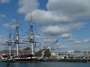
The Charlestown Navy Yard is home to the USS Constitution, the USS Cassin Young, one of the first two dry docks in the US, and the USS Constitution Museum.

Great fun. Plan for a several hour visit.

The Museum is free, donation requested

Open 9-5 daily. Closed Christmas, New Year’s Day and Thanksgiving

National Park Service website:

http://www.nps.gov/bost/historyculture/cny.htm

National Park Service Maritime History website:

http://www.nps.gov/nr/travel/maritime/bns.htm

USS Constitution Museum website:

http://www.ussconstitutionmuseum.org/

Museum phone: (617) 426-1812

Public transportation: Green or Orange line to North Station (in Boston proper). Alternative, 93 Bus to Sullivan Station Bunker Hill.

Plan at least an hour for a cursory view of the Navy Yard. If visiting the Navy Yard along with Constitution, plan 2+ hours.

If coming from downtown, the Water Shuttle from Long Wharf is an excellent and fun way to travel and see the harbor at the same time.

Background Information

In 1800, the government purchased the land for the Charlestown Navy Yard at Moulton’s Point, and established the yard itself shortly thereafter. (Moulton’s Point is where the British troops landed for their attack on the Patriots during the Battle of Bunker Hill.) In 1814, the yard launched the first US ship of the line, the USS Independence.

Multiple Navy Yard ships saw service in the Civil War – however, it was primarily a repair and storage facility until the 1890s. At that time, it started to build steel-hulled ships.

The Navy Yard reached its height of activity during World War II, with peak employment in 1943 of 50,128 men and women – working around the clock, 7 days a week. The yard then covered 130 acres with 86 buildings and 3.5 million square feet of floor space. A second dry dock was also added.

During this peak period, the Navy Yard could build a Destroyer Escort in four months and an LST (Landing Ship Tank) in less than four weeks. Overall, between 1939 and 1945, the Navy Yard built 30 destroyers, 60 escort vessels, overhauled and repaired 3,500 ships, and outfitted over 11,000.

After World War II, the Navy Yard was involved with upgrading the fleet and modifying World War II ships for Cold War service. Being so far from the fighting, the Navy Yard did not receive much work during the Korean and Vietnam conflicts.

As part of cost cutting measures, President Nixon ordered the yard closed in 1974. Many Bostonians believe the Nixon administration made that decision to punish Massachusetts, the only state to vote against him in 1972.

Since the closing, the bulk of the facility has been recycled and developed. The thirty acres that were transferred to the National Park Service became part of the Boston National Historical Park, with a mission “to interpret the art and history of naval shipbuilding.”

Dry Dock 1

US Cassin Young in Dry Dock 1

US Cassin Young in Dry Dock 1

Dry Dock 1 was one of the first two dry docks put into service the United States, missing out on the honor of being first by only a week – that distinction when to Norfolk, Virginia. Dry docks are important to avoid the tedious, expensive and dangerous process of careening or “heaving down” a ship to work on its hull. Careening requires leaning a ship over on its side, which puts great stress on its hull and only exposes one side at a time. In fact, sometimes ships would sink during the careening process.2

The need for dry docks was understood from the beginning of the US Navy, but construction did not begin until 1827 and then took six years to complete. The project was designed and under the control of Loammi Baldwin, considered the father of civil engineering in the United States.

The granite for this project, as well as the dry dock in Norfolk, came from Quincy – the same site that provided the granite used for the Bunker Hill Monument. Dry Dock 1 opened in June of 1833 and its first customer was the USS Constitution.

There are excellent interpretive displays that show how the dry dock works and illustrates the alternative careening method.

USS Cassin Young

The USS Cassin Young is a World War II Fletcher-Class Destroyer commissioned on the last day of 1943. She served with distinction in the Pacific, including during the Battle of Leyte Gulf. She received damage during two separate kamikaze attacks during 1945, one of which killed twenty-two and wounded forty-five sailors.

Visitors can tour the ship, with or without guides. ID is required.

Cassin Young website

The photograph in the Dry Dock 1 section above shows the USS Cassin Young.

Muster House

Muster House

Muster House

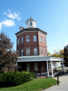
The interesting eight-sided Muster House was built in 1852 and was an administrative building for the Navy Yard. The clock and bell were used to assemble civilian employees for work at a time when most workers did not wear watches.

Rope WalkRope Walk

Rope has always been is an essential element of ships, so having quality and production control was a key aspect of the US Navy’s strategic plan. The USS Constitution, for example, requires over four miles of rope.

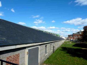
The Ropewalk at the Navy Yard produced most of the cordage used by US Navy between 1838 and 1955 – in 1942 alone producing over 4 million pounds! It had a ¼ mile of rope-laying area, allowing it to produce rope of up to 1200 feet in length as rope is twisted in a straight line. Its innovative steam-powered machinery could produce rope of much higher strength than manual techniques. The Ropewalk was used until 1971.

Although the building is still standing, it is boarded up and there is not much to see. There are interpretive displays in the National Park Service Visitor Center that you walk through prior to boarding the USS Constitution. These explain the rope making process and illustrate the rope walk in operation.

Commandant’s House

Commandant's House

Commandant’s House

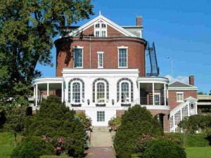
The Commandant’s House was built in 1805 and was home to the Navy Yard’s commanders and their families for many years. It has hosted five U.S. presidents and many dignitaries and foreign heads of state.

There are no visitors allowed inside.

Copp’s Hill Burying Ground – Freedom Trail Stop 14 Overview

Copp's Hill Burying Ground - Freedom Trail Stop 14 - 1659

Copp’s Hill Burying Ground – Freedom Trail Stop 14 – 1659

Select your language to auto-translate:

EnglishEspañolFrançaisDeutschItalianoDansk中文(简体)中文(漢字)日本語한국어PortuguêsTürkçeالعربية

Site of British Battery During Battle of Bunker Hill

Founded in 1659, Copp’s Hill’s permanent residents include the Puritan ministers Increase and Cotton Mather, Robert Newman (the patriot who hung the lanterns that signaled “two if by sea” in Old North Church), and Prince Hall, the father of Black Freemasonry.

Free – public park  Closed as it gets dark  Official website:

http://www.cityofboston.gov/parks/hbgi/CoppsHill.asp

Handicap access limited as it is up a steep hill from Old North Church and there are several steep granite steps to climb in order to enter the burying ground.  No restrooms

Public transportation: Green or Orange line to North Station.

Plan 10-15 minutes to walk through and view the grave sites.

Background Information

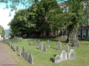
Copp’s Hill Burying Ground, the second oldest in Boston, was founded in 1659. It takes its name from William Copp, the North End shoemaker who was the original owner of the land. The hill is the highest in the North End and originally was the sight of windmills, the source of its original name of Windmill Hill. The burying ground was extended several times as the need increased. The earliest grave markers date to 1661.

On the Snow Hill Street side are the many unmarked graves of the African Americans who lived in the “New Guinea” community at the foot of the hill. In addition to the graves, there are 272 tombs, most of which bear inscriptions that are still legible.

Among the Bostonians buried here are the family of the original owner, William Copp, as well as Robert Newman (the Sexton of the Old North Church who hung the “two if by sea” signal lanterns). Also here is Prince Hall along with many unmarked graves of African Americans who lived on Copp’s Hill. Prince Hall was one of the most influential free black leaders in the late 1700s. Hall is known for his work for education rights, as an early abolitionist, and as the father of Black Freemasonry.

The most historically significant memorial is the Mather Tomb, the final resting place for Increase (1639-1723) and his son Cotton Mather (1663-1728). Both Mathers were powerful and politically active ministers of the Old North Meeting House (Boston’s Second Church), which was in North Square by the Paul Revere House. They were directly involved in the hysteria surrounding the Salem witch trials which damaged their reputations.

When the British occupied the city during the Siege of Boston, in 1775-1776, Copp’s Hill Burying Ground was used for target practice. You can still see impact marks from British musket balls, particularly on the headstone of Captain Daniel Malcom. There’s even one in the eye of the skull!

Copp’s Hill was also the site of British cannons that were mounted to protect the harbor. During the Battle of Bunker Hill, these cannons were used to bombard Charlestown prior to the British assaults. You can see the Bunker Hill Monument and the USS Constitution from the back of the Burying Ground.

Narrowest House

Diagonally across the street from the Burying Ground entrance is the narrowest house in Boston. It is 10.4 feet (3.16 m) at its widest, it tapers to 9.2 feet (2.82 m) at the back. It was allegedly built as a “spite house” a little after 1874.

Freedom Trail Tour Guide – Maps, Sites, Tips & Secrets

Select your language to auto-translate:

EnglishEspañolFrançaisDeutschItalianoDansk中文(简体)中文(漢字)日本語한국어PortuguêsTürkçeالعربية

“… just the right mix of content to make for a terrific tour…” David J. Asher  “Saved me with visitors from the West Coast…”  Steve S.

Download the free companion Apps – use with the Guide or when visiting the Freedom Trail!

For the iPhone                 For Android 

The Freedom Trail Boston – Ultimate Tour & History Guide provides everything you need to bring your visit to The Freedom Trail to life. Use it to plan your visit, as a interactive tour guide, or even as a souvenir! Includes FREE STREAMING AUDIO NARRATION – a personal tour guide in your pocket (requires web access)!

The most comprehensive guide available, by far!

  • Overview and detailed background information for all 16 Official and >50 Unofficial Freedom Trail Stops
  • Side trips to Harvard Square/Cambridge, Lexington, Concord, Adams NHP, & Boston Harbor Islands
  • Available in print or ebook formats.
  • Print version retains ebook features with QR Code access to auto-translate and web materials
  • > 70 photographs, maps and illustrations
  • Auto-translate all major book chapters (with web-access) into Spanish, French, German, Italian, Japanese, Chinese, Korean and more
  • Access to additional free information including an interactive Google Map Tour, an Android app and iPhone/Pad app
  • Budget tips including the best free guided-tours, where to find a bargain lobster, historic restaurants, and even a harbor cruise for $3 (children are free)
  • Detailed itineraries for an hour, 1/2, full and two day visits. Learn exactly what to visit with your limited time
  • Child-friendly and family-oriented tips
  • Descriptions of all the events that bring the Freedom Trail to life including the Boston Massacre, the Boston Tea Party, Paul Revere’s Ride, the Battles of Lexington and Concord, and the Battle of Bunker Hill – more than is provided by any other tour guide


What is The Freedom Trail?

Freedom Trail Logo Boston

Welcome to The Freedom Trail

The Freedom Trail is the largest attraction in New England, with over three million visitors a year. It is fun, walkable, accessible, family-friendly, engaging, and a bargain. You can see it in 1/2 a day, or spend several days and still want more.

Select your language to auto-translate:

EnglishEspañolFrançaisDeutschItalianoDansk中文(简体)中文(漢字)日本語한국어PortuguêsTürkçeالعربية

And, Boston has everything you might want in a destination – world class museums, fantastic restaurants, shopping, sports, music, theater and history. It’s a unique and charming place that can feed almost any passion. There are great options for almost any budget, even a bargain lobster lunch.

So, what is it? The Freedom Trail is a 2.5 mile red brick path  (mostly brick – some lines are painted) that connects 16 significant historic sites, referred to as “Stops” throughout this blog.  The Trail starts at Boston Common and officially ends at the Bunker Hill Monument in Charlestown.

Most of the Stops are free and many are handicapped accessible, but some may be difficult to navigate for non-walkers. For the few that charge admission, there are discounted tickets available.

The original idea for The Freedom Trail was conceived by William Schofield, a long-time journalist for the now defunct Boston newspaper, the Herald Traveler. In 1951, Schofield had the idea for a walking path that connected Boston’s great collection of local landmarks. With the support of local historians, politicians and businessmen, the Freedom Trail was born.

In addition to the official Stops, there are many “unofficial Stops” you pass as you traverse the Trail, or are very near by. Most unofficial Stops are directly associated with Revolutionary Boston and The Freedom Trail, but some are simply interesting places.  Many folks include them in their Freedom Trail visit.

So, how should you plan for your visit, and for how long? The posts on Planning to Tour, Part 1 and Part 2, will give you an overview of all the official Stops, a sense of how long it takes to visit each, and alternative itineraries for 1/2, full and two day tours. Use this free custom Google Map to help visualize your visit – it is practically a full blown self-touring guide in itself. For a complete view of The Freedom Trail, get a copy of the “Freedom Trail Boston – Ultimate Tour & History Guide – Tips, Secrets & Tricks“.

The influence Boston had on the thinking and actions that led to the American Revolution was extraordinary. Without Boston and its unique history, the American colonies break with Great Britain may have still happened, but not when and how it did. The Freedom Trail presents the essence of Revolutionary Boston and brings its amazing impact to life.

Enjoy, Boston is a unique city and The Freedom Trail is a national treasure.

The Freedom Trail Tour Planning – Part 2

In Part 1 of this series, I provided an assessment for the time needed to visit each of the 16 official Freedom Trail Stops. In this post, I’ll suggest itineraries for 1/2, full and two day tours. If you can, plan for a full day (or more), especially if you want to spend time visiting any particular Stop. However, if it’s all you have, a 1/2 day is still fantastic, and it takes two days for an in-depth visit.

Select your language to auto-translate:

EnglishEspañolFrançaisDeutschItalianoDansk中文(简体)中文(漢字)日本語한국어PortuguêsTürkçeالعربية

Below find alternatives for 1/2 day, full day and two day visits. Use the custom Google Map referenced here to help you visualize what you are seeing and help as you walk your tour.

Most of the downtown Stops are close together. Walking directly from Boston Common (Stop 1) to Faneuil Hall (Stop 11) is only about .6 miles (1 km) and takes less than 15 minutes. Walking from downtown Faneuil Hall to the Paul Revere House in the North End (Stop 12) takes 10-15 minutes, but you pass through the Blackstone block, one of my favorites and a great place for a lobster lunch.

The Charlestown Stops (USS Constitution and Bunker hill) are another 15+ minute walk from the last Stop in the North End (Copp’s Hill Burying Ground), and there is a 10+ minute walk between the USS Constitution and Bunker Hill. If you can, save energy for the climb up the Bunker Hill monument, the view from the top is spectacular on a nice day.

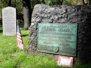
Sam Adams & Boston Massacre Victims in Granary Burying Ground

Sam Adams & Boston Massacre Victims in the Granary Burying Ground

To review, the official stops are:

Stop 1 – Boston Common.

Stop 2 – The Massachusetts State House.

Stop 3 – Park Street Church.

Stop 4 – Granary Burying Ground.

Stop 5 – King’s Chapel.

Stop 5a – King’s Chapel Burying Ground.

Stop 6 – Boston Latin, Old City Hall, Franklin Statue.

Stop 7 – Old Corner Book Store.

Stop 8 – Old South Meeting House.

Stop 9 – Old State House.

Stop 10- Boston Massacre Site.

Stop 11 – Faneuil Hall and National Park Service visitor center.

Stop 12 – Paul Revere House.

Stop 13 – Old North Church.

Stop 14 – Copp’s Hill Burying Ground.

Stop 15 – USS Constitution and the Charlestown Navy Yard.

Stop 16 – Bunker Hill Monument.

1/2 Day Tour Recommendations:

Option 1: (Downtown) Walk by Stops 1 – 3, visit Stops 3 – 5, walk by 6-8, visit 9, walk by 10, and visit 11. Lunch and break at Faneuil Hall Market or the Blackstone Block area.

Option 2: (Downtown and North End): Walk by Stops 1 – 3, visit Stops 3 – 5, walk by 6 – 10, visit 11, walk by 12, visit 13 and 14. Lunch and break in Faneuil Hall Market, the Blackstone Block or the North End.

Option 3: (Charlestown – USS Constitution and Bunker Hill): Visit Stop 15 USS Constitution (bypass the Constitution Museum and USS Cassin Young), visit Bunker Hill Monument and Museum. Lunch at the Warren Tavern or at the Navy Yard.

Option 4: (Charlestown, USS Constitution): Spend a full 1/2 day visiting the USS Constitution, the Museum, USS Cassin Young and walk around the Navy Yard. Lunch at the Navy Yard or across the Bridge in the North End.

Option 5: (A little Downtown, free ranger-guided tour, North End, USS Constitution – requires a lot of walking and tour-time coordination): Start at Stop 11, Faneuil Hall, and listen to the NPS Great Hall talk, take the NPS  tour that goes to the North End, visit Stops 13 – 15, take the Water Shuttle back to Long Wharf.

Full Day Tour Recommendations:

Boston and the North End: Walk by Stops 1-3, visit Stops 3-5, walk by 6-7, visit 8 and 9, walk by 10, visit 11, lunch or break in Faneuil Hall Market, the Blackstone Block or the North End, visit 12-14.

Charlestown: spend a full 1/2 day visiting the USS Constitution, the Constitution Museum, USS Cassin Young and walk around the Navy Yard, lunch around the Navy Yard or at the Warren Tavern, visit the Bunker Hill Monument and Museum.

If you want to visit the entire Freedom Trail in a single day, it is recommended that you combine Options 2 and 3. It will be busy and there is a lot of walking, but you will have a great time.

Two Day Recommendations:

For a two day visit, combine both of the full day recommendations. It is worth the time if you can spare it.

What would I do?

If I could fit in a flexible half day, especially with kids, without question Option 5. This requires planning to fit in the National Park Service ranger tours, but is absolutely worth it. Start at Faneuil Hall  and enjoy the Great Hall ranger talk (every 1/2 hour) and get a sticker for the ranger-tour that goes to the North End (currently at 12, 2 & 3 PM – stickers available 1/2 hour prior. Confirm times at the NPS visitor center.) After the tour, visit Old North Church (Stop 13), walk through Stop 14, then walk quickly to Stop 15 and take the USS Constitution tour. Take the Water Shuttle back to Long Wharf (every 1/2 during non-commuting hours). Grab lunch where you can.

If I only had half a day, wanted to self-guide, and could not coordinate times for Option 5, I’d recommend Option 2 with a lobster lunch in the Blackstone Block. See as much as you can, and the North End has fantastic character and European feel. Don’t miss a Faneuil Hall tour or visiting the Old State House. If you are not from New England, the lobster is not to be missed.

If I had a full day, combine Options 2 and 3. The downtown stops are great and I love the Navy Yard and USS Constitution (it is easy to spend too much time here). Bunker Hill and the Bunker Hill museum are excellent. Have a lobster lunch in the Blackstone Block or grab some character and a Paul Revere Burger at the Warren Tavern in Charlestown (I’d choose the lobster, but it may be too early in your day).

Have a great visit.

The Freedom Trail Tour Planning – Part 1

Select your language to auto-translate:

EnglishEspañolFrançaisDeutschItalianoDansk中文(简体)中文(漢字)日本語한국어PortuguêsTürkçeالعربية

The entire Freedom Trail is only 2.5 miles long, but seeing it all in one day is difficult,  especially if you want to spend time visiting any particular Stop. To help you plan your visit, I’ve provided a quick assessment for each of the official 16 Stops, its significance to the Revolutionary period, and the recommended time needed for a visit. Where relevant, I’ve also mentioned unofficial Stops you will pass along the way.

In Part 2 of this series, there are specific recommendations for 1/2, full and two day tours. Use this custom Google Map to help visualize and plan your tour.

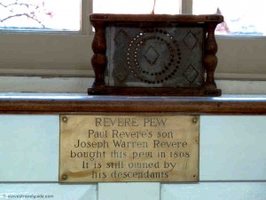
Paul Revere Pew in Old North Church

Revere Pew in Old North Church

Stop Review:

Note: Most of the downtown (Stops 1 through 11) are close together. Walking directly  from Boston Common to Faneuil Hall is only about .6 miles (1 km) and takes less than 15 minutes.

Stop 1 – Boston Common. A great old park, but unless you want to walk around the park and enjoy the outdoors, there is not much of prime historical importance to see. There is a good playground for younger children at Frog Pond.

Stop 2 – The Massachusetts State House. There are excellent guided tours and it is a fascinating and elegant old building, Plan 1.5-2 hours to pass through security and take the tour. While it is worthwhile, there is not much relating to the Revolutionary period as the State House was built after the Revolution. Take the time to view St. Gauden’s Robert Gould Shaw & MA 54th Memorial across the street at the edge of Boston Common.

Stop 3 – Park Street Church. Closed for viewing except during the summer. Unless you take a tour, it will not take much time. There is little of primary Revolutionary significance.

Stop 4 – Granary Burying Ground. This is the final resting spot for Sam Adams, John Hancock, Paul Revere, Mother Goose, the Boston Massacre victims, and others. Plan about 15 minutes to walk through.

Stop 5 – King’s Chapel. Great old church usually open for viewing. Plan 15 minutes to walk through.

Stop 5a – King’s Chapel Burying Ground. The oldest in Boston, plan about 10 minutes to walk through and view the old stones. Not much of Revolutionary significance as the Burying Ground was full well before 1700.

Stop 6 – Boston Latin, Old City Hall, Franklin Statue. Everything is outside (there is no interior viewing of Old City Hall). Plan 5-10 minutes to view the outside plaques.  If you want to see the Province House steps, plan for another 5 minutes to walk up Province Street.

Stop 7 – Old Corner Book Store. You will walk by and see the house, which now houses a Chipotle Mexican Grill. Nothing to tour.

Stop 8 – Old South Meeting House. Plan 1/2+ hour to view inside and the exhibits. The Meeting House is interesting given the number of important Revolutionary-era meetings that took place here. There are interpretive exhibits that place the building and its events in history and a good three dimensional map of Revolutionary-era Boston that highlights key locations – fascinating given the city’s changing topology. Check their web site for other programs. Benjamin Franklin’s birthplace and the Irish Memorial are directly across the street and are quick to see.

Stop 9 – Old State House. The Old State House features excellent docent-given tours and talks that cover the building and Revolutionary events. The museum has some good displays and exhibits. Plan about an hour to visit and take a tour. Highly worthwhile.

Stop 10 – Boston Massacre Site. This is a plaque embedded in the street directly below the balcony of the Old State House. This is a walk-by with a photo opportunity.

Stop 11 – Faneuil Hall. This is a great old and important building. Go inside and enjoy a Ranger-led talk (given every 30 minutes). Plan for 30-45 minutes to visit the Hall. The Faneuil Hall Marketplace (Quincy Market) is located next door, and is a good place to stop, get something to eat or shop. Plan accordingly. The new National Park Service visitor center is located in the first floor of Faneuil Hall.

Note: From Faneuil Hall, it is a 15 minute walk to the next official Stop, the Paul Revere House, in the North End. On the way, you pass some interesting unofficial Stops in the Blackstone Block area – the Holocaust Memorial, Union Oyster House, Marshall Street, and the Ebenezer Hancock House. The Blackstone Block is also a good, less commercial place to take a break or to eat. Some of the local restaurants feature good lobster specials at lunch.

Stop 12 – Paul Revere House. Built in 1680, it is the oldest structure remaining in Boston. It is a good example of a period dwelling and you will gain insights into Paul Revere’s life. The costumed docents provide interesting descriptions of the house and the Revere family. Visiting is worthwhile, but the house is small, consisting of only four rooms. Plan for about 1/2 hour.

Note: It is about a 10 minute walk through the North End to the next stop. The North End is also an excellent place to stop for lunch. It has a very European feel and many wonderful restaurants.

Stop 13 – Old North Church. A beautiful and important church, the oldest remaining in Boston. A walk through takes about 15 minutes. Purchase the $1 pamphlet that illustrate the highlights.

Stop 14 – Copp’s Hill Burying Ground. An 5 minute walk up hill from the Old North Church. Plan about 10-15 minutes to walk through the Burying Ground. There are a few interesting graves, a headstone used by the British for target practice, and a nice view of the harbor.

Note: From here there is another 15+ minute walk across the bridge to Charlestown and the next Stop, the USS Constitution.

Stop 15 – USS Constitution and the Charlestown Navy Yard. Visiting the Constitution and the Museum can easily be a half day visit. For the Constitution alone, plan at least an hour to pass through security, view the small museum and take the guided tour of the ship. The very good USS Constitution Museum (different from the small museum attached to the Constitution), is worth another hour. A walk around the USS Cassin Young will take another 1/2 hour. Walking around the Navy Yard area is also a pleasure, and there are a few restaurants in the neighborhood. This is a highly worthwhile 1/2 day, especially for children, who will enjoy exploring the ships.

Note: There is another 15 minute walk between the Charlestown Navy Yard and the Bunker Hill Monument and Museum. For a historic lunch, try the Warren Tavern, which is only a short detour between the two sites.

Stop 16 – Bunker Hill Monument. To tour the monument area, plan about 15-20 minutes, unless you plan to make the 294-step ascent to the top. That is a fun activity and provides a spectacular view of Boston and the surrounding area. If climbing the Monument, plan 1/2 hour. To visit the Bunker Hill Museum, which is excellent and best seen before the monument, plan another 1/2 to full hour. The museum features exhibits on the battle and Charlestown history, and has ranger-guided programs – great for children. If you have time, visit the Museum before the Monument. Highly recommended.

Freedom Trail Boston Video Virtual Tour in 5 Minutes

A 5 minute comprehensive video walk through of The Freedom Trail, it features all the 16 official Freedom Trail Stops, more than 50 unofficial Stops, historic restaurants, and other interesting places in and around The Freedom Trail – all included in theFreedom Trail Boston – Ultimate Tour Guide – Tips, Secrets & Tricks eBook. It moves fast as it contains almost 150 photos and video segments, so keep your pause key handy if you want to view anything in detail. A must see for anyone visiting The Freedom Trail and Colonial Boston.

The video was created as a companion to the  eBook “Freedom Trail Boston – Ultimate Tour and History Guide,” now available on Amazon.com. The Guide covers all of the sites in the video and more. In addition to any touring information the reader might need, the Guide provides detailed historical context from the time of Boston’s founding through events like the Boston Massacre, the Boston Tea Party, Paul Revere’s Ride, the Battles of Lexington and Concord, and the Charles Bulfinch era. In short, it contains everything someone might want to know to visit and enjoy The Freedom Trail and Revolutionary Boston.

For a companion map to the video, see my custom Google Map posting. The map includes everything in the video.

Enjoy the video!

Freedom Trail Historic Boston Restaurant Guide & Map


View Freedom Trail Boston – Ultimate Tour Map & Guide in a larger map

For those visiting the Freedom Trail and wishing the immersive experience, there are a number of historic restaurants directly on or close to the Freedom Trail.

The Google Map above displays these restaurants along with the sixteen official Freedom Trail stops and many other interesting sites on or near the Freedom Trail.  It is also available as a free Android app (iPhone/iPad versions to be available soon).

All these restaurants, sites and much is discussed in the eBook “Freedom Trail Boston – Ultimate Tour & History Guide – Tip, Secrets, & Tricks“.

BTW, none of these restaurants should be considered “fine dining,” with the possible exception of the Chart House. But, all are fun and serve good food.  And, they will absolutely enhance your Freedom Trail experience.  Most have excellent lunch specials.  Enjoy!

1654 – Green Dragon Tavern

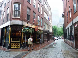
Green Dragon Tavern Boston on Historic Marshall Street

Green Dragon Tavern on Historic Marshall Street

The original Green Dragon Tavern was a around the corner at 84 Union Street. It was founded in 1654 and an active pub by 1714. The Green Dragon was a regular haunt for the Sons of Liberty and the site of the Boston Tea Party planning meetings.  It was torn down in 1828.

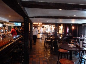
The current Green Dragon incarnation is fun and has decent bar food.  It is located on Marshall Street, one of the oldest most authentically historic in Boston.  Right next door is the Ebenezer Hancock House – which built in 1767 by John Hancock’s uncle, inherited by John and then given to his brother, Ebenezer.  Ebenezer became the deputy paymaster to the Continental Army.

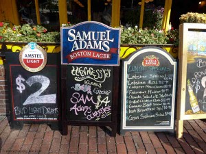
Special at the Green Dragon Tavern Boston

Lobster Specials at the Green Dragon Tavern Boston

Good lunch specials, including lobster.  Everyone needs at least one lobster when visiting Boston!

Green Dragon Tavern website

617-237-2114

1742 (perhaps 1713) – Union Oyster House

Union Oyster House on Boston Freedom Trail

Union Oyster House

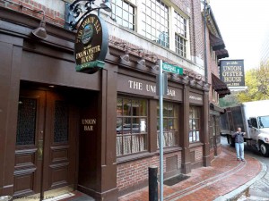
The Union Oyster House started serving in 1826. It is the oldest continuously operating restaurant in the US.  The building, which dates from 1742 (although other references place it as early as 1713), started its life as a dress shop.  At that time, the harbor actually came up to the dress shop’s back door.  Since then, all the land you see has been filled in.

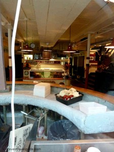
Old Bar at the Union Oyster House

Daniel Webster’s Seat at the Union Oyster House

The legendary Oyster Bar at the front of the restaurant is beautiful and historic.  Regular customer Daniel Webster sat daily at this bar and drank a tall tumbler of brandy and water with each half-dozen oysters – usually eating at least six plates.

Union Oyster House website

617-227-2750

1760 – Chart House

Chart House Restaurant - Hancock's Counting House - 1760

Chart House Restaurant – John Hancock’s Counting House

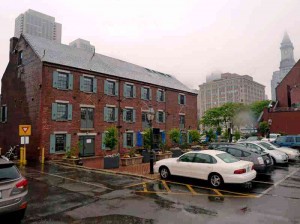
The Chart House was originally the Gardiner House, built on Long Wharf around 1760. Later, it was John Hancock’s counting house.  It is the oldest building still in use on Long Wharf.

For the pleasant weather, it has outside seating with a great view of the harbor and downtown Boston. It is the most elegant restaurant in this collection.

Chart House website

617-227-1576

1780 – Warren Tavern

Warren Tavern Charlestown - by Bunker Hill

Warren Tavern – by Bunker Hill

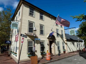
Built in 1780, the Warren Tavern was reportedly the first building raised after the British burned Charlestown during the Battle of Bunker Hill in 1775. It is named for Doctor and General Joseph Warren, the famous Patriot who was killed at Bunker Hill. It was visited by George Washington, Paul Revere, and Benjamin Franklin.

Warren Tavern in Charlestown - by Bunker Hill

Warren Tavern – Historic and Good Pub Food by Bunker Hill

Good pub food and great slice of history.

Warren Tavern website

617-241-8142

Freedom Trail Maps with Google Map Tour

Any visitor to the Freedom Trail and Colonial Boston will need good maps.  Here are several – all free.

The Google map below was created for the eBook Freedom Trail Boston – Ultimate Tour and History Guide. In itself, the map is almost a full tour guide and includes the essentials for all the official, as well as many interesting unofficial Freedom Trail sites. All of the Official Stops come with web-based auto-translate links that allow the user to specify the language for the post. A great feature for non-English comfortable users.

The map also provides information such as operating hours, websites, phone numbers, admission costs and handicap access notes.  There are even listings for the best historic restaurants. Here is a video post that includes all the sites listed in the map.

The map is also available as a FREE full-blown Android app, downloadable from Google Play as well as from the Amazon App Store. The app exposes all the best features of Google Maps and is, by far, the most usable way to use the map. It  performs better than using a browser, is much less awkward, and lets you keep the map easily identifiable and ready to launch.

Use it (at your own risk as travel information is subject to change), enjoy it, and please comment.  Pass the link on to your friends.

View Freedom Trail Map & Historic Boston Guide in a larger map


Next is a series of official Freedom Trail maps from the US National Park Service (NPS).  These are savable, printable,  well done and all paid for by US tax dollars.

The main Freedom Trail Map, which is the same that you will see on the NPS Freedom Trail Guide paper guide, is available here.  It is also available from The Freedom Trail Foundation here.  Additionally, there are other relevant visitor maps available from the National Park Service – for the whole series click here.  In addition to the official Freedom Trail map mentioned above, there is a less detailed Freedom Trail map with an outline of Boston’s harbor line at 1775 – fascinating for historical context.  Click here for the 1775 overlay map.  The series also includes maps for the Charlestown Navy Yard,  Boston Harbor in WW II, a map that shows walking distances between Boston sites (Boston is a very walkable city), and a guide for tour bus parking.


Paul Revere, George Washington and John Adams Face to Face at Boston MFA

The Boston Museum of Fine Arts is awesome, and it’s the only place you can see some of the most influential leaders of the American Revolution up close and personal.  John Singleton Copley’s vivid and compelling portraits of Paul Revere, Sam Adams, John Hancock and Joseph Warren are intimate and perceptive.  Gilbert Stuart’s works of George Washington are superb, and you can even see the original portrait used as the model for the U.S. one dollar bill.  This is as close as you can get to shaking hands with these leaders of the American Revolution today.

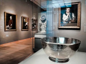
Revere’s Sons of Liberty Bowl with Copley’s Portraits of Revere, Samuel Adams, John Hancock, & Dr. Warren

Located on the first floor of the MFA’s Art of the America’s Wing, the first thing you meet upon entering the gallery is Paul Revere’s 1768 “Son’s of Liberty Bowl.” The silver bowl was commissioned by fifteen members of the Sons of Liberty to honor the Massachusetts House of Representatives for standing up to the British after the Townshend Acts in 1767.  The chain of events set off by the Townshend Acts, and the troops Britain sent to quell the associated Colonial turbulence, was to lead inexorably to the Boston Massacre in 1770 then on to the American Revolution.

The Townshend Acts taxed imported commodities, including paper, glass and tea.  The Massachusetts House of Representatives sent a “Circular Letter” to other colonies asking for their support to protest the Acts – which resulted in boycotts of British goods by Royal colonies.  In Boston, resistance was so intense that British custom officials requested military assistance.  After the HMS Rodney, a 50-gun warship, arrived in Boston harbor, the Colonials rioted and Britain sent 4 regiments of troops to restore order. The presence of the troops led directly to the Boston Massacre.

Directly behind the bowl is Copley’s 1768 portrait of Paul Revere, painted when Revere was thirty three years old.  The portrait was unusual for the period, as it shows Revere without the traditional gentleman’s coat and wig.  (Revere’s family thought it made him look like a workman and actually hid it in the attic.)  The portrait works on many levels, both as a discerning picture of Revere and as a political statement.  Note Revere’s flaunting display of flowing linen shirtsleeves – the linen was manufactured in Boston in direct defiance of British laws.   Flanking the portrait are two cases of Revere’s silver – incredible works of art on their own.
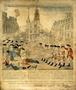
Paul Revere’s Engraving of the Boston Massacre

On the wall to the left of Revere’s portrait you will find four important Revolutionary works, one an engraving and three Copley portraits of Boston revolutionaries.  The engraving is Paul Revere’s highly sensationalized depiction of the March 1770 Boston Massacre.  The Massacre took place after an unfortunate chain of events led British soldiers to fire on an angry Boston mob, killing five and wounding six.  Although hardly a massacre (most of the soldiers were later acquitted of blame) it was to be an important event provoking colonial unrest.  The famous engraving you see was a key piece of Patriot propaganda used to help move America closer to its break with Great Britain.

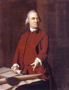
Sam Adams at 50 in 1772

Next is the 1772 portrait of Samuel Adams.  Adams is shown defiantly pointing to a petition from angry Boston citizens after the Boston Massacre.   The portrait was commissioned by John Hancock to hang in his Beacon Street mansion which was located at the southwest corner of the current Massachusetts State House site.

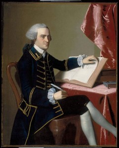
John Hancock at 28 around 1765

Next is John Hancock himself, painted in 1765 when he was twenty-eight.  Hancock is best known for his flamboyant signature on the Declaration of Independence, and he was a multidimensional architect of the Revolution.   A successful merchant, he was one of the richest people in America and personally funded much of the Boston-based dissension.  He was president of the Massachusetts Provincial Congress (the Patriot shadow government that was formed after the Boston Tea Party in 1774), the second Continental Congress, which created the Declaration of Independence, and later served as the first Governor of the State of Massachusetts.

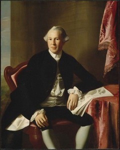
Joseph Warren at 24 around 1765

Further down the wall is the sensitive portrait of Dr. Joseph Warren at the age of twenty-four, also painted around 1765.  Warren was one of the most influential Patriot leaders, and served as President of both the Massachusetts Committee of Safety and the Provincial Congress.   After the April 1775 Battles of Lexington and Concord, he strongly advocated going to war with Britain.  Even though he had limited military experience, he was appointed a major general.  He died fighting as a private during the Battle of Bunker Hill on June 17, 1775.   John Trumbull’s painting “The Death of General Warren at the Battle of Bunker’s Hill” is shown elsewhere in the exhibit.

The exhibition features a number of other Revolutionary-themed works including Copley’s 1796 portrait of John Quincy Adams, the son of John Adams and the sixth President of the United States, and John-Antoine Houdon’s 1789 portrait of Thomas Jefferson.

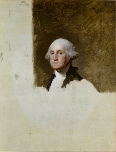
George Washington at 64 “The Athenaeum Portrait” – on the U.S. One Dollar Bill

The next exhibit room features some monumental works by Gilbert Stewart, including the 1796 unfinished portrait of George Washington, known as “The Athenaeum Portrait.”  This painting was used as a model for more than fifty other works, including the image on the U.S. one dollar bill.  Also displayed are Stuart’s portrait of Martha Washington and his idealized 1806 painting of Washington at Dorchester Heights.

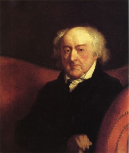
Other Revolutionary works in the same exhibit include Thomas Sully’s 1819 huge painting “The Passage of the Delaware” and Gilbert Stuart’s 1805 painting of General Henry Knox.  General Knox led the expedition that brought the cannons used to lift the Siege of Boston.  He then became chief artillery officer of the Continental Army and later Washington’s Secretary of War.  Stuart’s 1823 portrait of John Adams, ninety at the time of the painting, rounds out the exhibit.  Look into Adams’ tired, sensitive eyes.

Stuart’s John Adams at 90

In all, the five rooms of this gallery contain a treasure of colonial furniture as well as many other important paintings from the 18th and early 19th century colonial America.   Visit and enjoy, whether you are a Revolutionary War enthusiast or not.


Photos of Paul Revere Bowl and Gallery Entrance showing Paul Revere and other Copley portraits, stevestravelguide.com – all rights reserved.

Other pictures from Wikimedia Commons – these works are considered public domain in the United States, and those countries with a copyright term of the life of the author plus 100 years or fewer.